India GIS Data Products


mapdata

India Assembly - Palriamentry constituency Map Data:

India is a democratic country, therefore in such democratic set up, time bound Elections are compulsory phenomenon.  By virtue of being the largest democracy 
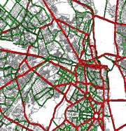
In the world, execution of the elections (either Lok Sabha or Vidhan Sabha) in the country like India is a hectic exercise.  To ease out such exercise, Election commission (EC) of India has decided the delimitation of parliamentary and assembly constituencies. To better understand the patterns of administrative
Boundaries, location of administrative units, parliamentary and assembly constituencies, each of them to be brought on a common platform.  With the help Of conventional method it could be achieved, but it required too much time and labour. To overcome such difficulty GIS technique comes as helping tool, in order to generate such comprehensive maps and that too in a precise manner.


  • Available for all India with 2008 delimitation.
   
   
  • Available for Every Assembly and Parliamentary constituencies.
   
   
  • Available in various Map format like MapInfo, ESRI, MID/MIF etc.
   
   
  • Available for to publish on websites.


Our Clients are

Transport Sector Telecommunication Sector Utility Sector Car Navigation Retail Sector Real Estate Sector

Services Overview

We provide digital and High Quality India GIS map data on very low and affordable price. Our mission is to provide on time Quality services to our clients. Following are some of our servicess

  • GIS data development & Management
  • GIS Application Develpment
  • GIS other servicess

Contact Us

If you have any Question. comments, feedback and suggetionss regarding our products, servicess please do not hessitate to write us on

Address: Karnataka, INDIA
Skype:gismaps.in
Gtalk:gismaps.in
E-mail: mapsgis@gismaps.in