India Election Maps
Enhancing election accuracy and efficiency through advanced GIS mapping. Precisely understand administrative boundaries and constituency locations

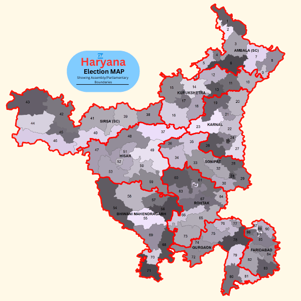
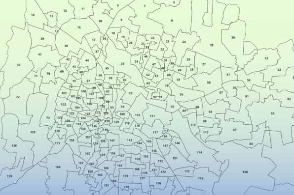
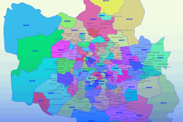
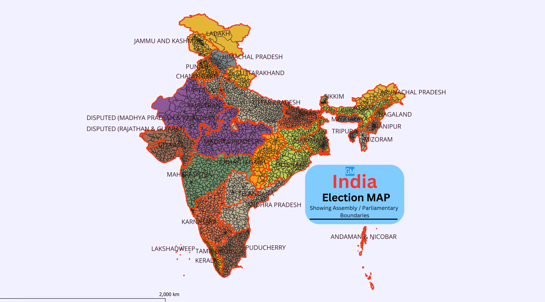
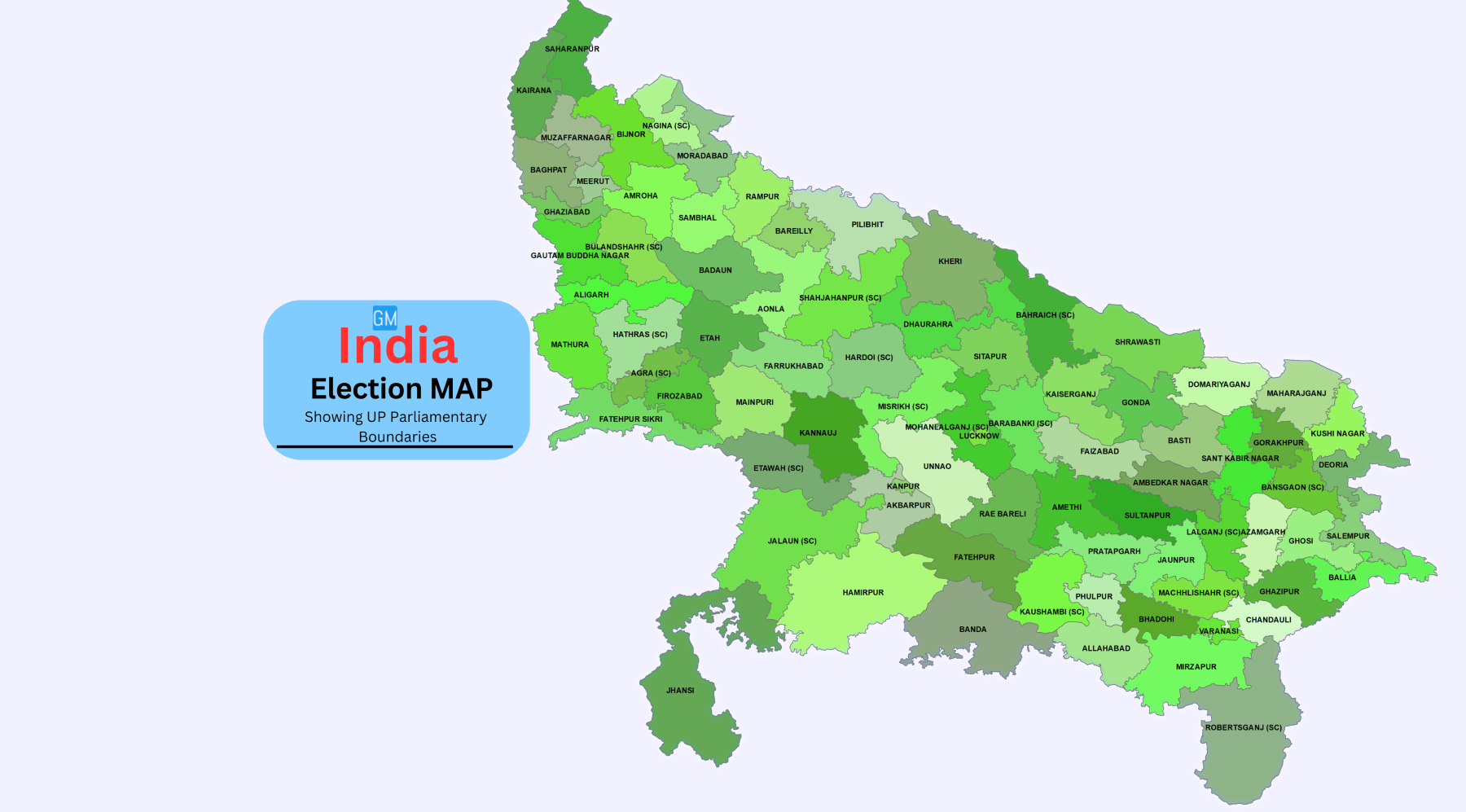
In India, a democratic country, timely elections are a fundamental aspect of governance. As the world's largest democracy, conducting elections, whether for the Lok Sabha or Vidhan Sabha, is a complex and demanding task. To streamline this process, the Election Commission of India has established the delimitation of parliamentary and assembly constituencies.

 Understanding administrative boundaries and the locations of these constituencies is essential, but traditional methods are time-consuming and labor-intensive.

 GIS technology offers an efficient solution, enabling the creation of comprehensive and precise maps that simplify the electoral process.

State Assembly Election Maps.

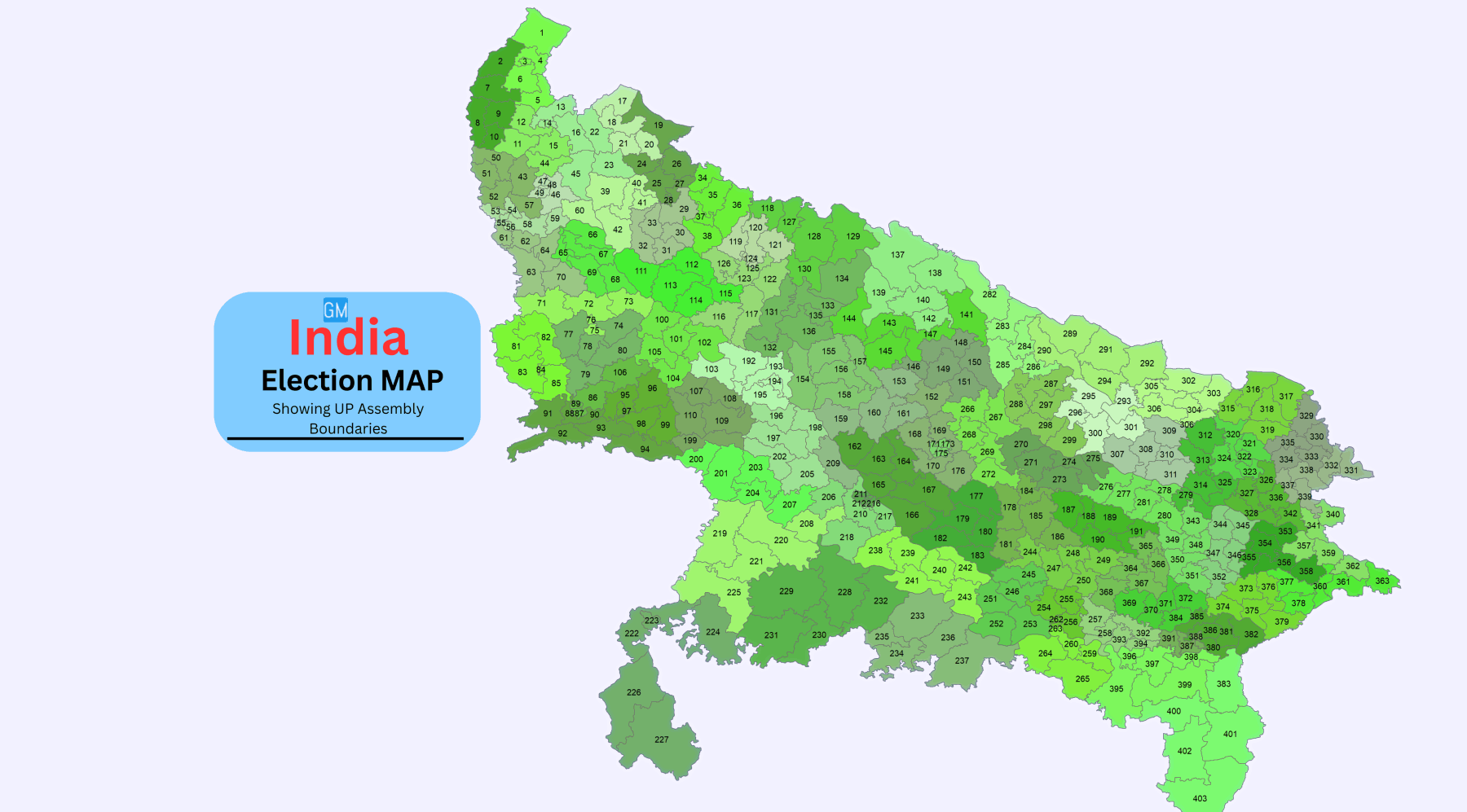
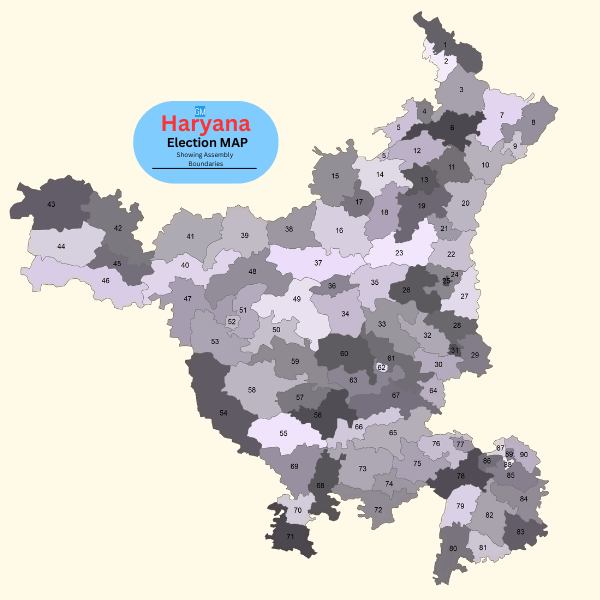
State Assembly Election Maps show the boundaries of each assembly. Gain clear insights into administrative boundaries and constituency locations. Our detailed GIS maps provide accurate and comprehensive visualizations. Simplify the electoral process with precise mapping.

India Haryana Election Map Showing Haryana Assembly Boundaries

State Parliamentary 
Election Maps.

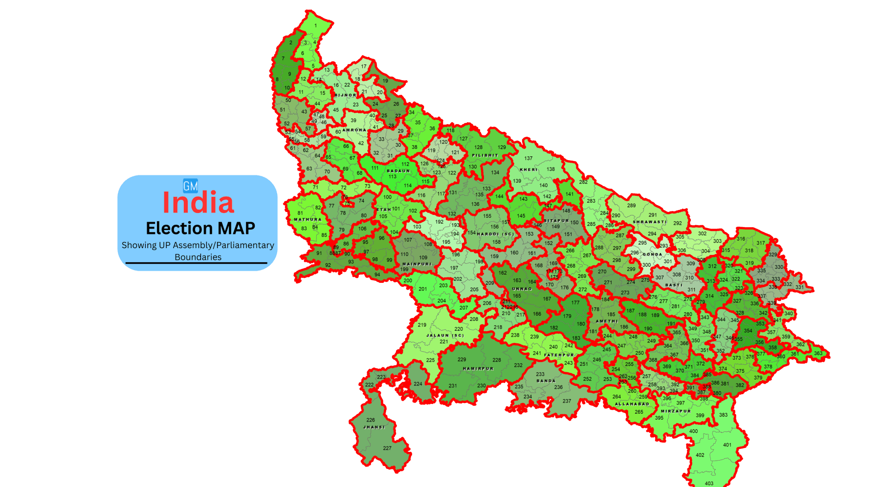
State Parliamentary Election Maps show the boundaries of each parliamentary constituency. Understand administrative boundaries and constituency locations. Our detailed GIS maps provide accurate and comprehensive visualizations. Simplify the electoral process with precise mapping.

India Haryana Election Map Showing Haryana Assembly and Parliamentary Boundaries

Features & Key Benifits

Distinct Visual Delineation

Clearly demarcate constituencies for easy comprehension.

Rapid Election Result Highlights

Quickly identify winners and key statistics using color-coded representations.

On-Screen Presentation

Display winning candidates, parties, votes, and margins for immediate access.

Engaging Visualization

Enhance user experience with visually appealing displays, surpassing traditional tabular formats.

Updated Maps

Reflecting the latest delimitation changes for accurate representation.


Interactive Tools

Enable real-time tracking of election results with built-in interactive features.


Seamless Compatibility

 Accessible across web and mobile platforms for versatile usage.

Intuitive Interface: 

Simplify data engagement with a user-friendly interface designed for dynamic interaction.

File Format

India GIS Data File Format GISMAP IN

EPS

India GIS Data File Format GISMAP IN

CSV

India GIS Data File Format GISMAP IN

JPEG

India GIS Data File Format GISMAP IN

KML

India GIS Data File Format GISMAP IN

KMZ

India GIS Data File Format GISMAP IN

PDF

India GIS Data File Format GISMAP IN

Esri Shape File

India GIS Data File Format GISMAP IN

Geojson

India GIS Data File Format GISMAP IN

SVG

India GIS Data File Format GISMAP IN

PSD

India GIS Data File Format GISMAP IN

TIFF

India GIS Data File Format GISMAP IN

TAB

Potential Users for Data

Potential Users for GISMAP IN Gis Data

Governments

Potential Users for GISMAP IN Gis Data

Political Parties

Potential Users for GISMAP IN Gis Data

Educational Institutes

Potential Users for GISMAP IN Gis Data

Media House

Potential Users for GISMAP IN Gis Data

Print Media

Potential Users for GISMAP IN Gis Data

Election Officials

Map Data Products

Ward Boundaries Map for Cities And Towns
Ward Boundaries Map for Cities 
6 Digit PIN Code Boundaries Map
Detail Street Level Maps Of Cities And Towns
Street Level Maps Of Cities
Locality And Sub Localities Boundaries Map
Locality Sub Loc  Boundaries Map 

Why Choose GISMAP IN ?

1000+

Happy Clients
National & International

200+

Projects

60+

Client Countries

20+

Years of Mapping Experience

Some Of Our Clients Are

GISMAP IN India GIS Data Clients

Other Services

6 Digit PIN Code Map Data
Village Boundaries Map
Detail City Level Map Data

Get in Touch

Reach Us

  • Phone: +91 8762727187
  • Email: mapsgis@gismaps.in
  • Address: Belgaum, Karnataka, India.
  • Working Hours: Mon-Fri: 9am-5pm