India State Level GIS Maps
Detailed state-level GIS data enriched with Census information. Available in various formats to support business analytics, research, and planning. Customizable overlays for comprehensive geographic insights.

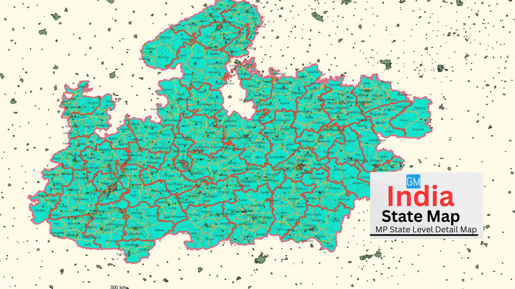
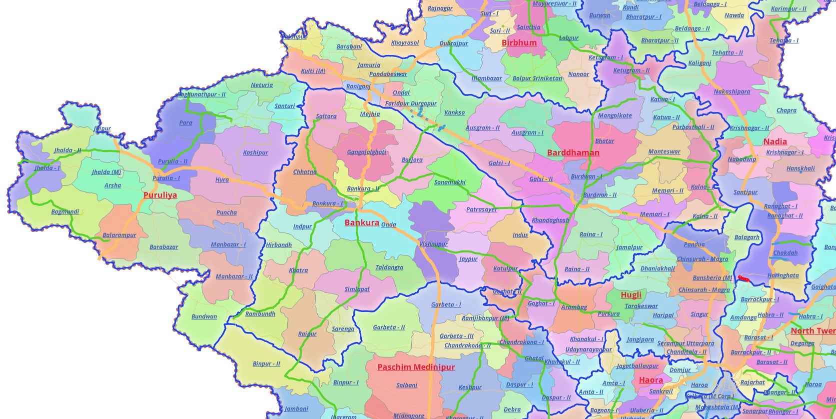
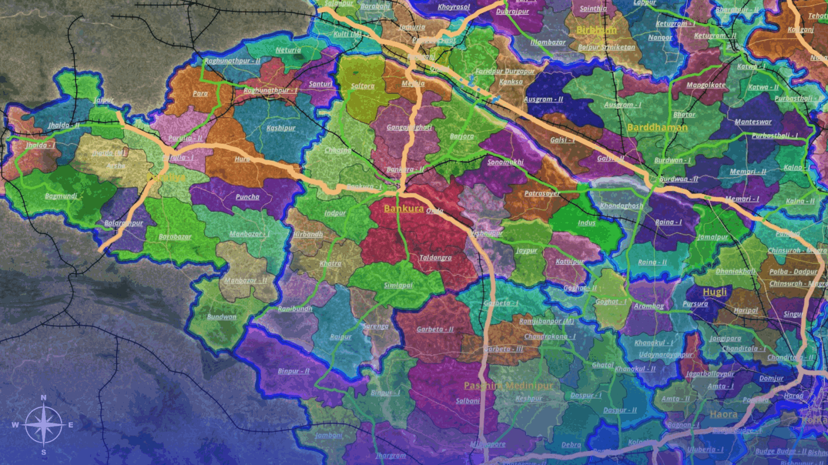
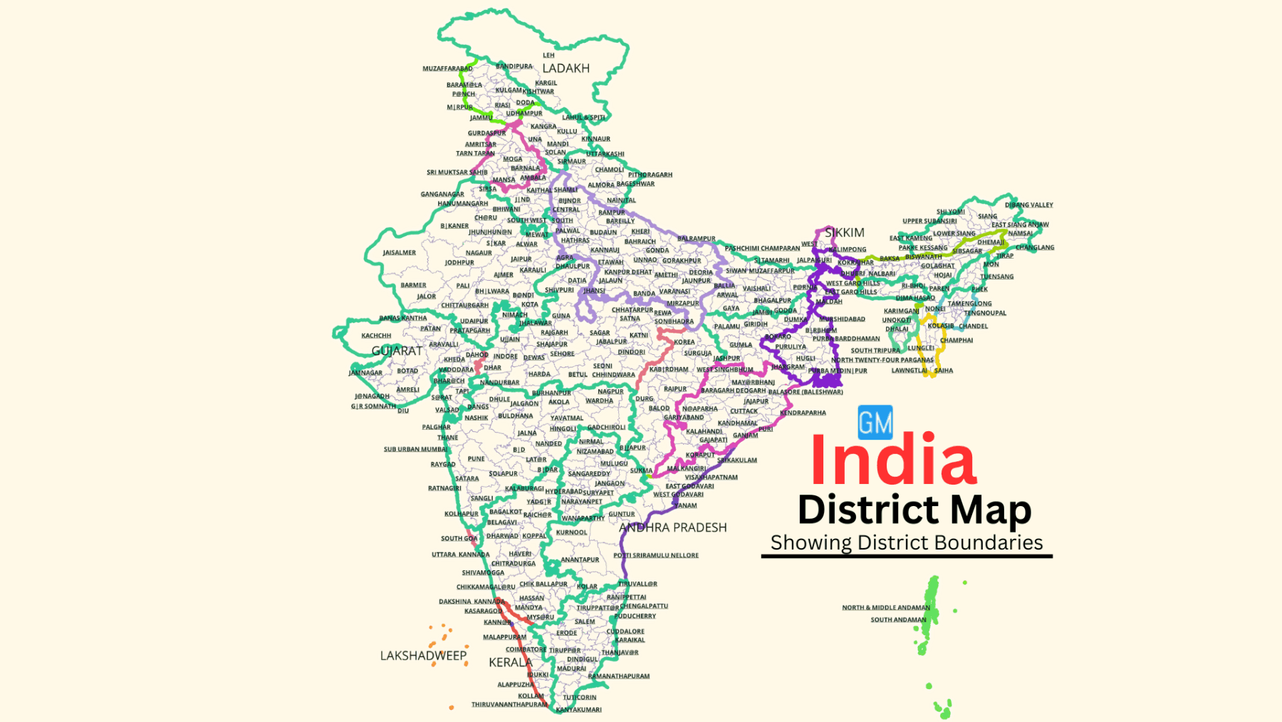
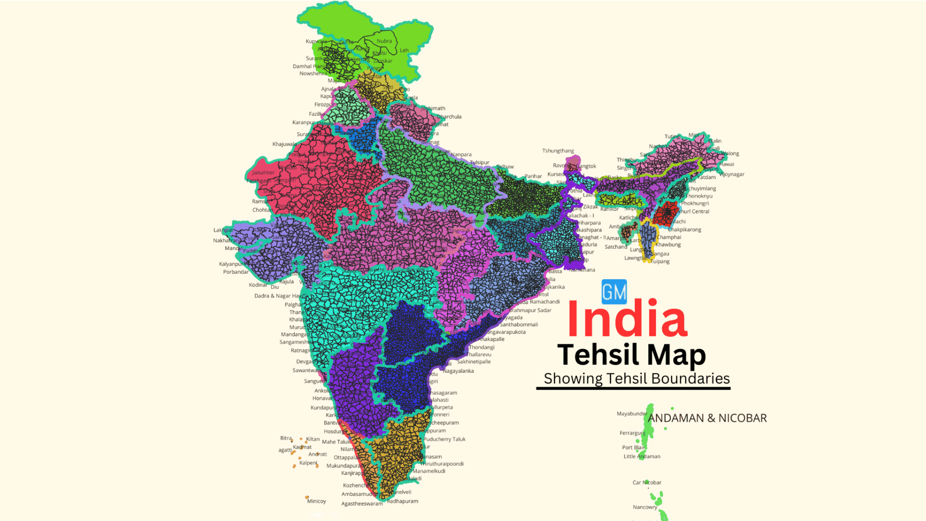
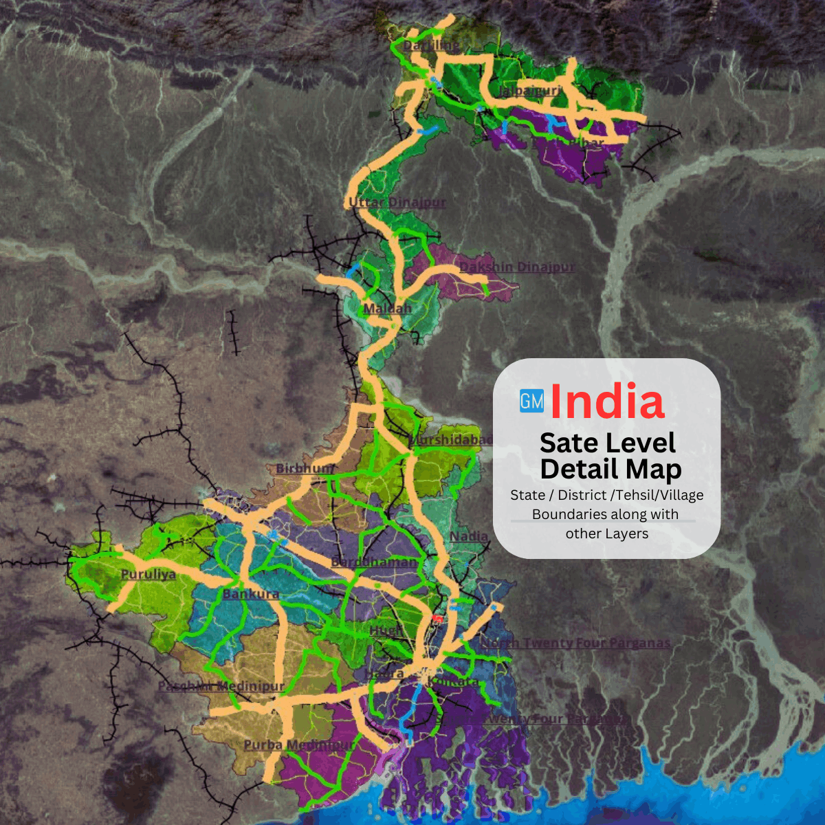
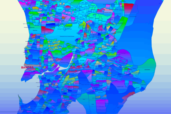
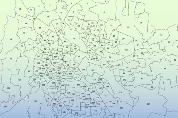
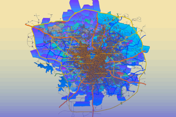
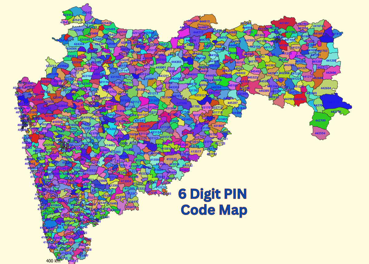
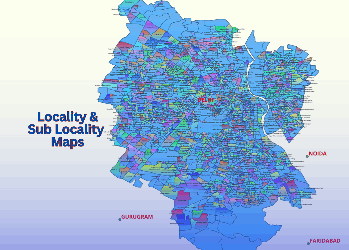
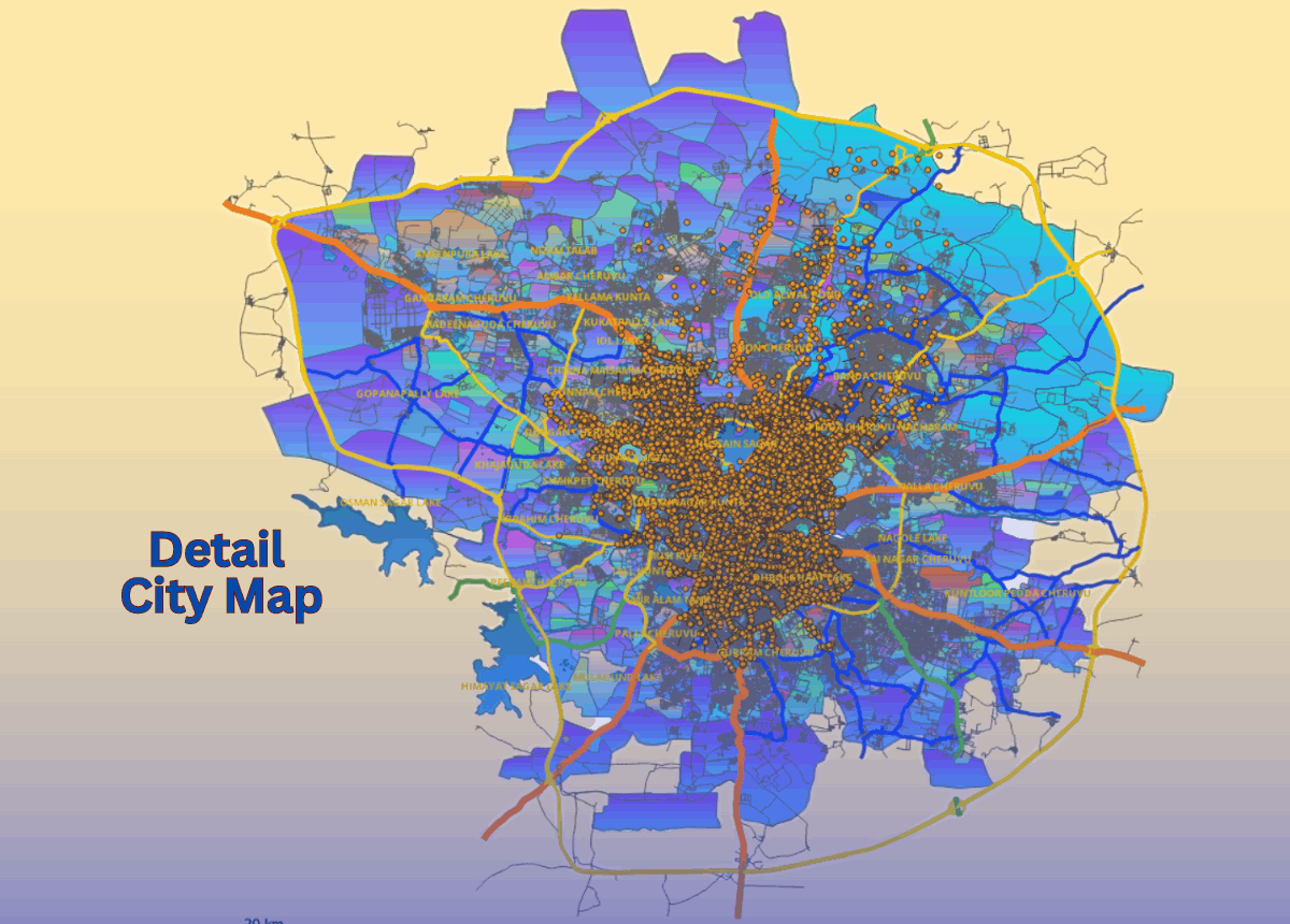
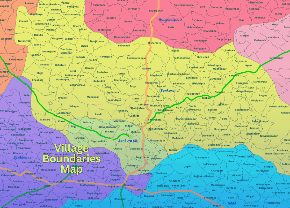
Our State Level GIS Map Data includes detailed delineations of districts, tehsils, and sub-districts, ensuring comprehensive coverage and accurate geographic information. Available in various formats such as AI, EPS, PDF, and GIS, our maps are compatible with diverse project needs and platforms.

 Whether you are planning sales territories, analyzing regional demographics, or conducting strategic site planning, our State Level GIS Map Data offers the detailed and customizable solutions you need. Enhance your projects with additional overlays for road networks, locality names, water bodies, and other critical layers to add more value to your analysis.

 With a commitment to accuracy and up-to-date information, GISMAP IN provides the tools necessary for informed decision-making and efficient planning. Access our user-friendly and customizable maps today to unlock the full potential of state-level geographic and demographic data.

India State Level Detail Map With Admin Layers

Admin Level and Detail 
Maps for All State / UT's
Of India.

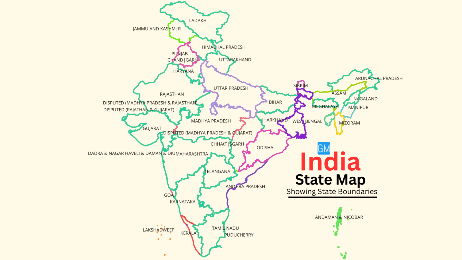
Map data available for all states and UTs of India, featuring comprehensive admin level and detailed maps. Each map is integrated with Census data, providing state-wise and district-wise insights for accurate analysis and planning. Our maps offer clear delineations of administrative boundaries, ensuring precise and up-to-date information. Whether you need data for business analytics, research, or strategic planning, our maps provide a robust foundation. Easily accessible and customizable, our maps are designed to meet the diverse needs of various sectors and applications.

Features & Key Benifits

Authentic Administrative Boundary Data.

Tailored to meet specific client requirements, ensuring flexibility and relevance for any project.

Integrated Census Data.

Enriched with demographic attributes for detailed analysis.

Various Map Formats Available

EPS, PDF, GIS, and more, to suit diverse project requirements.

Future Business Planning.

Optimize sales territories and strategic site planning.

Socioeconomic Studies:

Analyze current socioeconomic conditions with precision.

Service Planning and Analysis.

Enhance planning and analysis of various services.

Additional Layers:

Overlays available for road networks, administrative divisions, locality names, water bodies, and more, adding substantial value to maps.

Customizable.

Tailored to meet specific client requirements, ensuring flexibility and relevance for any project.

File Format

India GIS Data File Format GISMAP IN

EPS

India GIS Data File Format GISMAP IN

CSV

India GIS Data File Format GISMAP IN

JPEG

India GIS Data File Format GISMAP IN

KML

India GIS Data File Format GISMAP IN

KMZ

India GIS Data File Format GISMAP IN

PDF

India GIS Data File Format GISMAP IN

Esri Shape File

India GIS Data File Format GISMAP IN

Geojson

India GIS Data File Format GISMAP IN

SVG

India GIS Data File Format GISMAP IN

PSD

India GIS Data File Format GISMAP IN

TIFF

India GIS Data File Format GISMAP IN

TAB

Potential Users for Data

Potential Users for GISMAP IN Gis Data

Governments

Potential Users for GISMAP IN Gis Data

Sales And Marketting

Potential Users for GISMAP IN Gis Data

Educational Institutes

Map Data Products

6 Digit PIN Code Boundaries Map
Locality And Sub Localities Boundaries Map
Locality Sub Loc  Boundaries Map 
Ward Boundaries Map for Cities And Towns
Ward Boundaries Map for Cities 
Detail Street Level Maps Of Cities And Towns
Street Level Maps Of Cities

Why Choose GISMAP IN ?

1000+

Happy Clients
National & International

200+

Projects

60+

Client Countries

20+

Years of Mapping Experience

Some Of Our Clients Are

GISMAP IN India GIS Data Clients

Other Services

6 Digit PIN Code Map Data
Village Boundaries Map
Detail City Level Map Data

Get in Touch

Reach Us

  • Phone: +91 8762727187
  • Email: mapsgis@gismaps.in
  • Address: Belgaum, Karnataka, India.
  • Working Hours: Mon-Fri: 9am-5pm

AI Website Generator