Locality And Sub Locality Boundary Map Data. 
Accurate and Up-to-Date Locality and Sub Localities 
Boundary Map Data for Over 500+ Tier 1, Tier 2, and Tier 3 Cities Across India

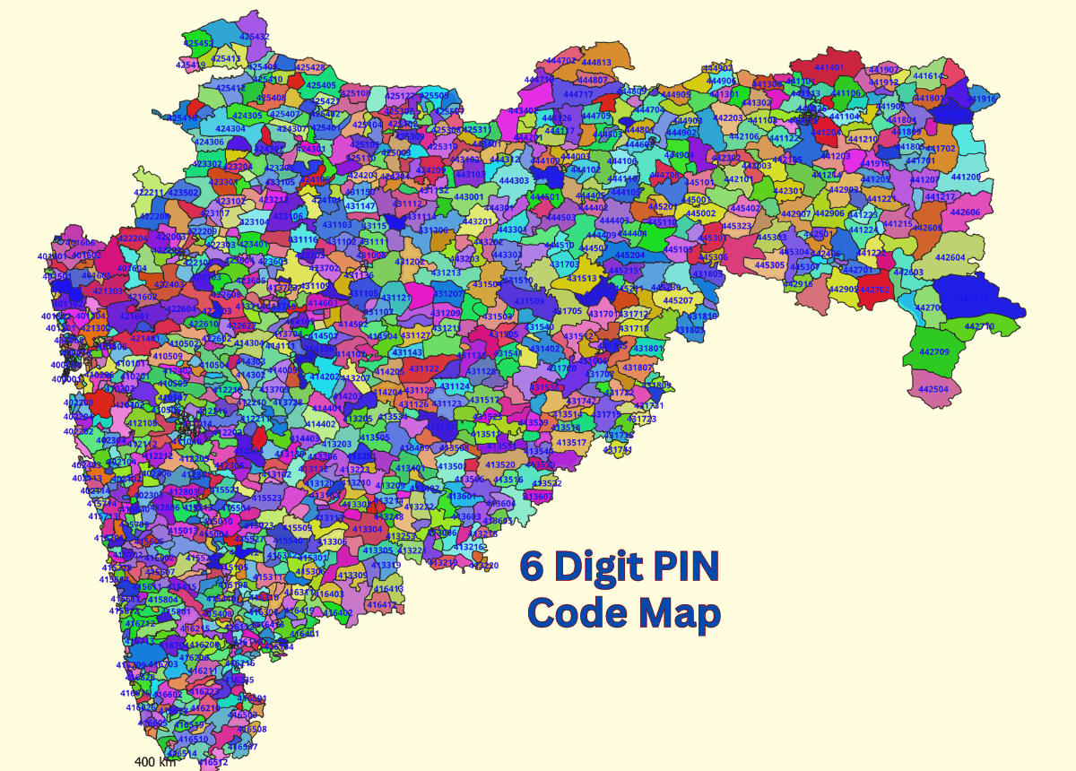
 GISMAP's extensive coverage of over 500 cities and towns in India, including Tier 1, Tier 2, and Tier 3 cities, means that it can cater to a wide range of needs and projects nationwide. This level of detail and comprehensiveness can be particularly beneficial for businesses, government agencies, researchers, and NGOs working in India.

This is an incredibly valuable resource for various applications, such as urban planning, infrastructure development, market analysis, and many others.

 By providing access to this map data, GISMAP enables stakeholders to analyze and visualize spatial information effectively, facilitating informed decision-making and resource allocation. It can also contribute to enhancing transparency, accountability, and efficiency in various projects and initiatives undertaken in urban areas.

Map Granularity
Locality Boundary Map.


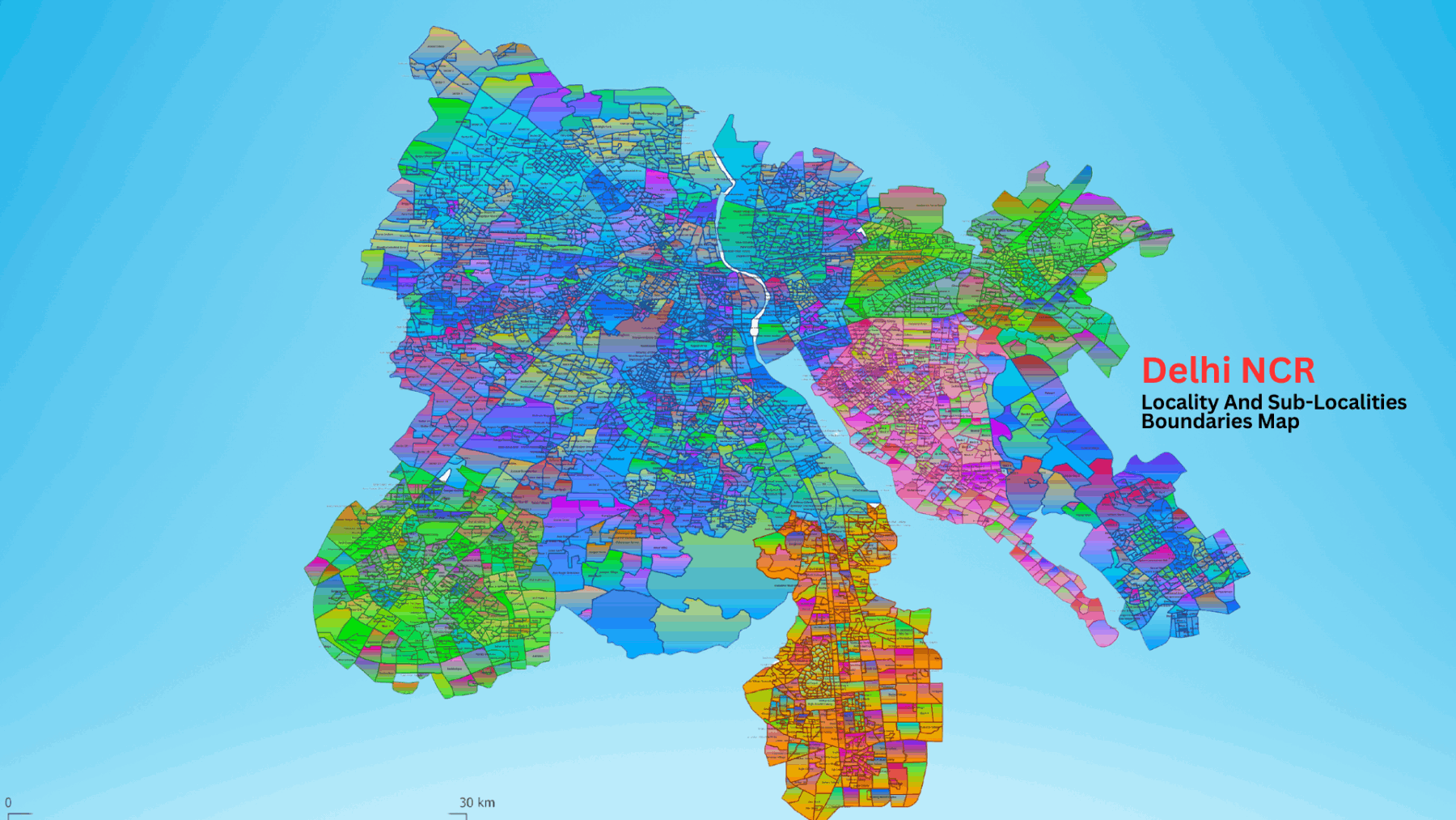
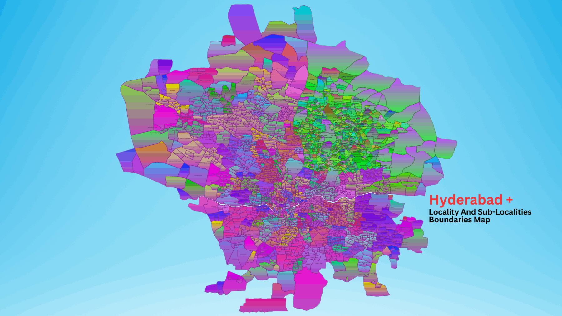
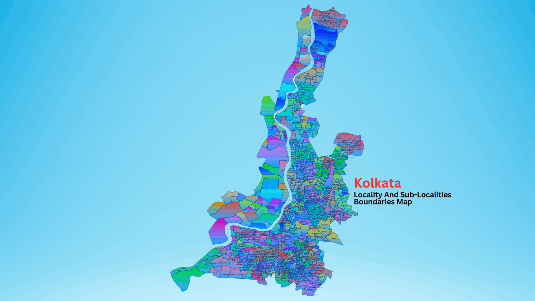
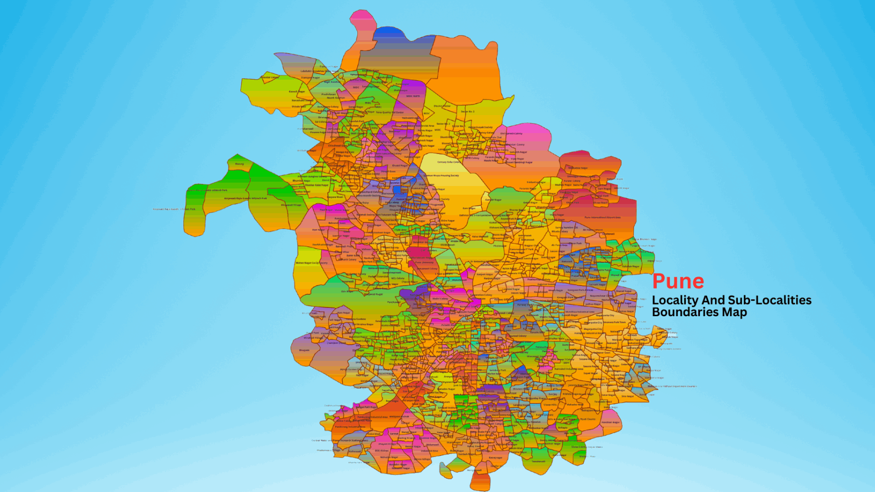
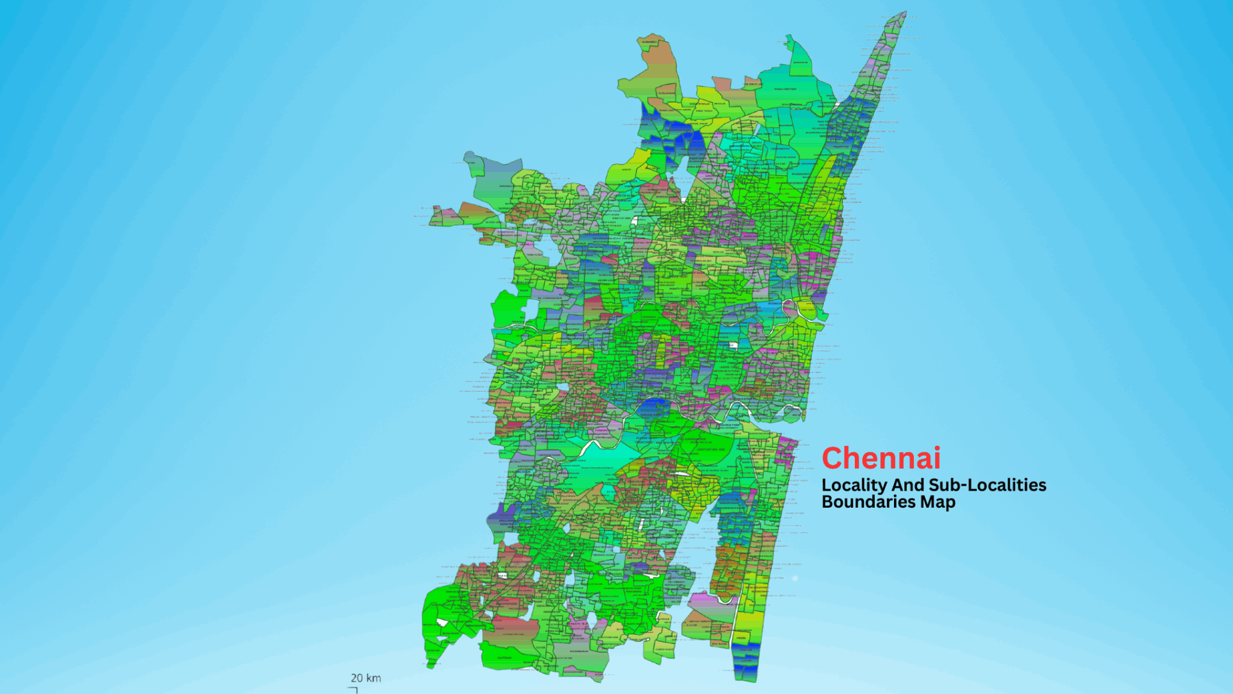
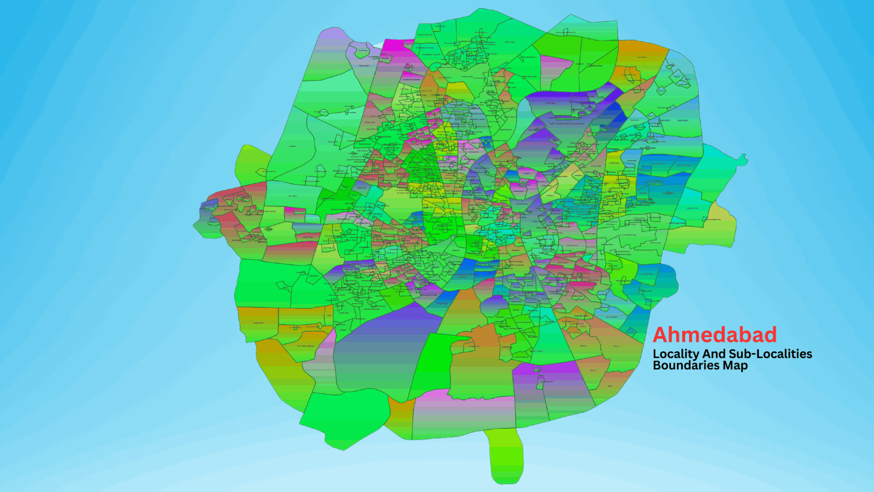
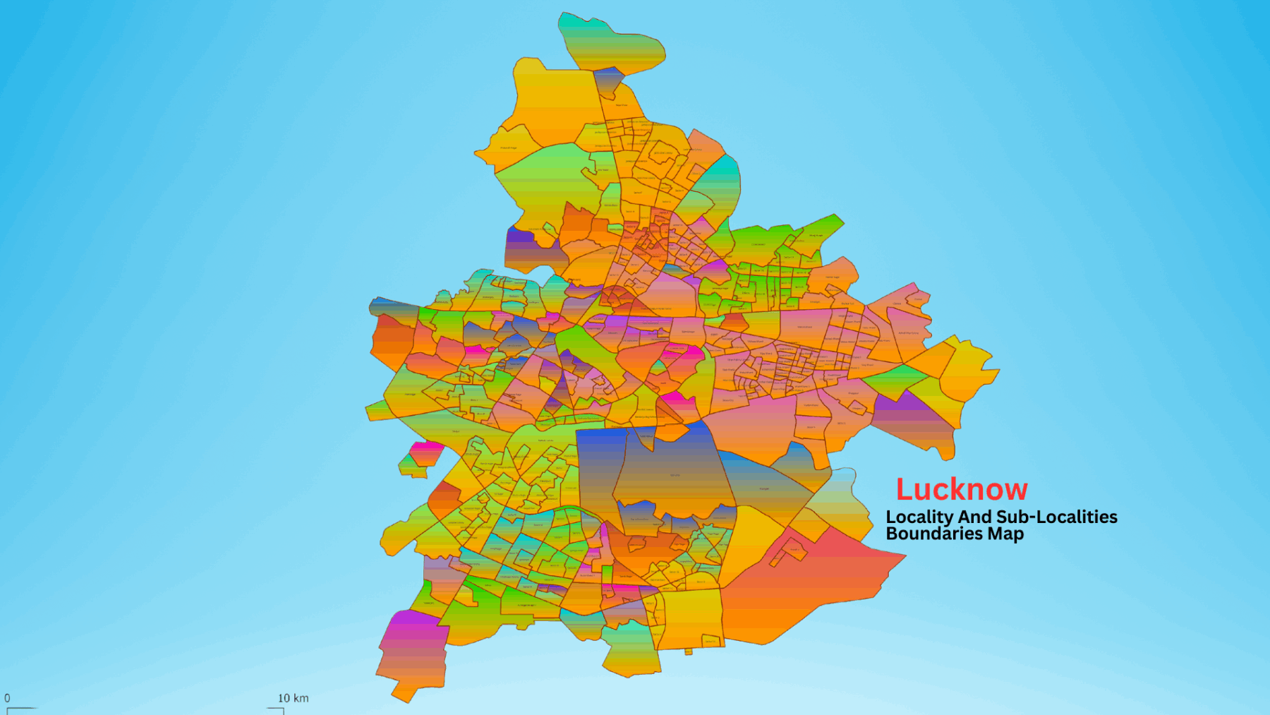
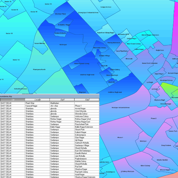
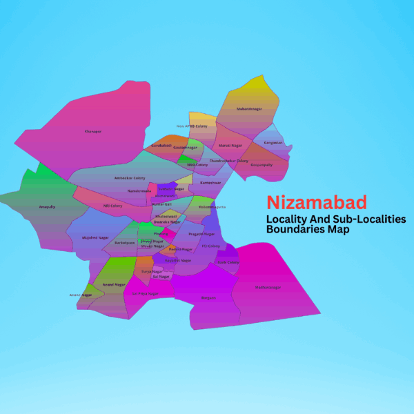
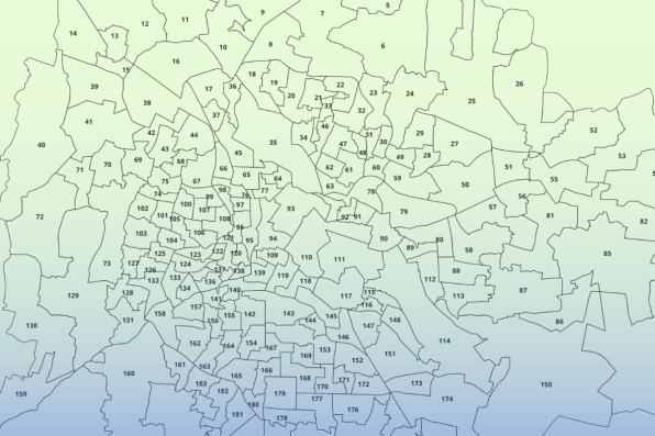
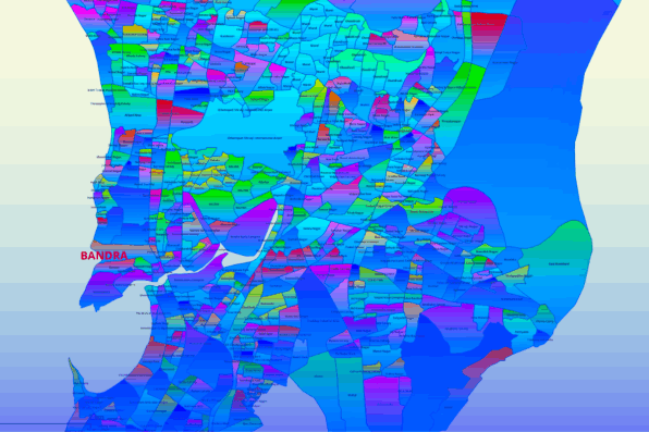
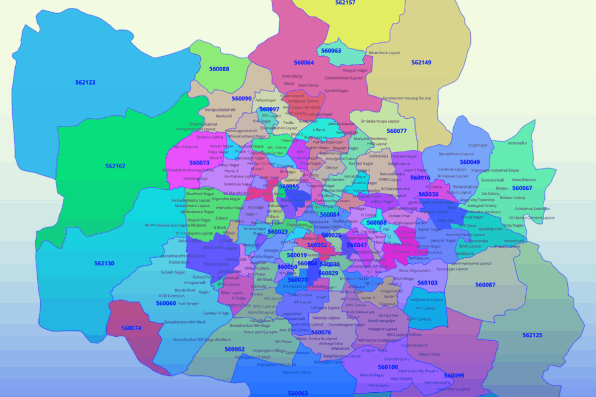
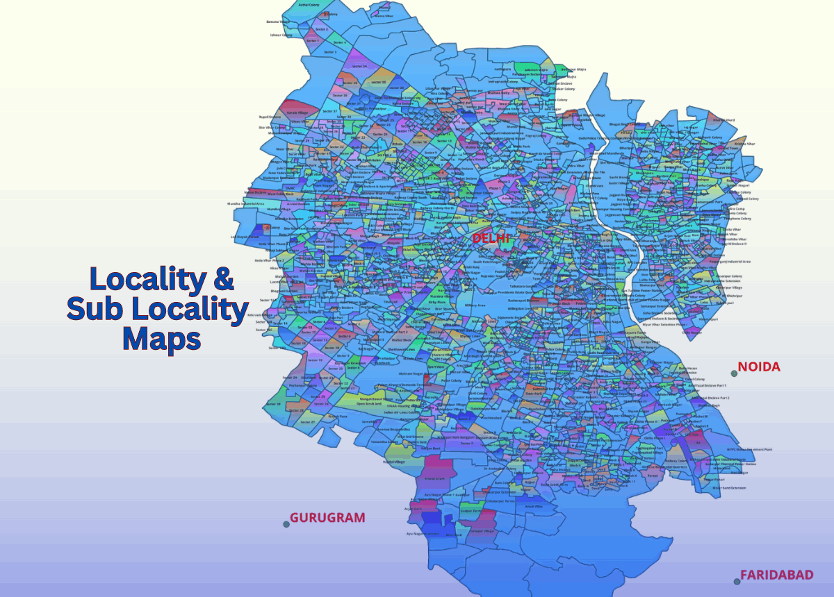
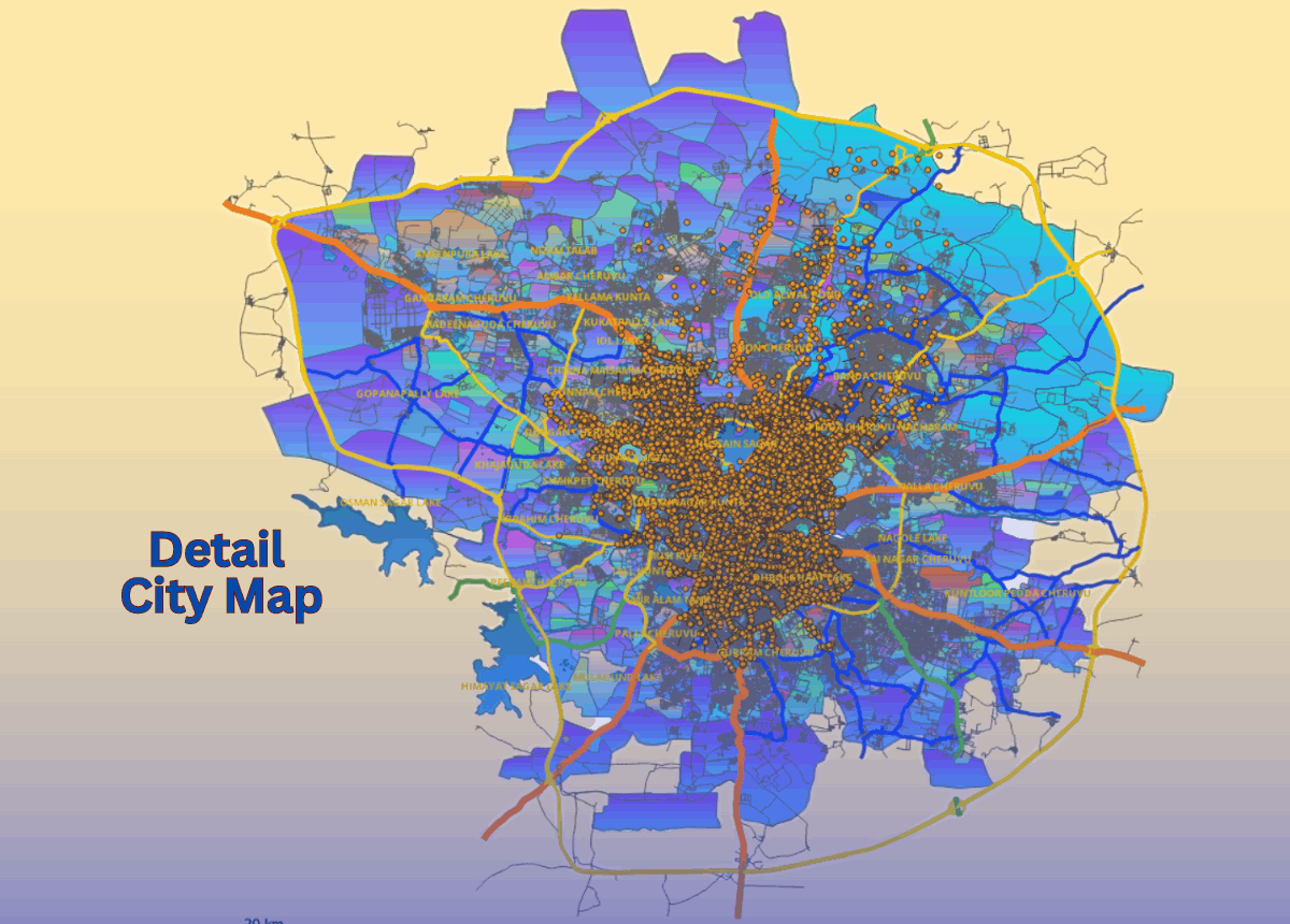
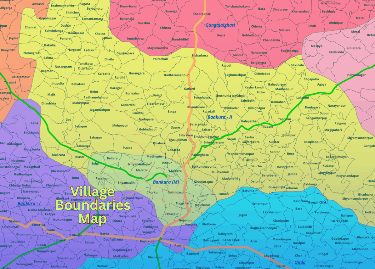
GISMAP IN provides highly granular mapping data of localities and sub-localities, structured hierarchically from main locality down to sub-locality levels, sometimes reaching up to sub-locality 3. This detailed data is invaluable for urban planning, logistics, real estate, market analysis, and emergency services by enabling precise decision-making, targeted service delivery, and enhanced analysis through the accurate delineation of geographical boundaries within cities and regions.

Localities and sub localities boundaries map

Map Coverage
Locality Boundary Map.

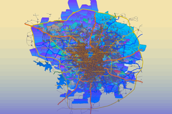
Locality Map coverage spans across various urban hierarchies, including tier 1 cities (major metropolitan areas), tier 2 cities (smaller metropolitan areas and significant urban centers), and extends to tier 3 cities, which include smaller towns and cities. This comprehensive coverage ensures that detailed locality and sub-locality boundaries are available for a wide range of urban environments, from large, densely populated cities to smaller, more rural towns, catering to diverse needs across different regions.

Tier 3 level localities and sub localities boundaries map data

Map Accuracy
Locality Boundary Map.

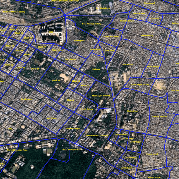
Our locality and sub-locality boundaries are accurately mapped onto satellite images, ensuring precise and reliable geographical data. This accuracy facilitates various applications by providing an exact overlay of administrative and geographical boundaries on up-to-date satellite imagery, which is crucial for tasks such as urban planning, logistics, real estate, and market analysis.

Localities and sub localities boundaries map on satellite image

Features & Key Benifits

Urban Planning.

Helps city planners design infrastructure projects, zoning regulations, and development initiatives with precision.

Logistics.

Optimizes route planning, delivery scheduling, and resource allocation for logistics companies.

Real Estate.

Assists real estate professionals in analyzing property values, market trends, and investment opportunities at a very detailed level.

Market Analysis.

Enables businesses to perform detailed demographic and market analyses to identify potential customers and optimize sales strategies.

Emergency Services.

Enhances the efficiency and effectiveness of emergency response teams by providing detailed maps for navigation and planning.

Accurate Decision Making.

Detailed boundaries allow for more informed decisions based on precise geographical data.

Targeted Services.

Helps in providing services that are tailored to the specific needs of smaller regions.

Enhanced Analysis

Facilitates detailed spatial analysis and informed decision-making by breaking down large areas into smaller, more manageable segments.

File Format

India GIS Data File Format GISMAP IN

EPS

India GIS Data File Format GISMAP IN

CSV

India GIS Data File Format GISMAP IN

JPEG

India GIS Data File Format GISMAP IN

KML

India GIS Data File Format GISMAP IN

KMZ

India GIS Data File Format GISMAP IN

PDF

India GIS Data File Format GISMAP IN

Esri Shape File

India GIS Data File Format GISMAP IN

Geojson

India GIS Data File Format GISMAP IN

SVG

India GIS Data File Format GISMAP IN

PSD

India GIS Data File Format GISMAP IN

TIFF

India GIS Data File Format GISMAP IN

TAB

Potential Users for Data

Potential Users for GISMAP IN Gis Data

Governments

Potential Users for GISMAP IN Gis Data

FMCG

Potential Users for GISMAP IN Gis Data

Sales And Marketting

Potential Users for GISMAP IN Gis Data

Real Estate

Potential Users for GISMAP IN Gis Data

E-Commerce

Potential Users for GISMAP IN Gis Data

Urban Planning

Potential Users for GISMAP IN Gis Data

Banks

Map Data Products

Ward Boundaries Map for Cities And Towns
Ward Boundaries Map for Cities 
Locality And Sub Localities Boundaries Map
Locality Sub Loc  Boundaries Map 
6 Digit PIN Code Boundaries Map
Detail Street Level Maps Of Cities And Towns
Street Level Maps Of Cities

Why Choose GISMAP IN ?

1000+

Happy Clients
National & International

200+

Projects

60+

Client Countries

20+

Years of Mapping Experience

Some Of Our Clients Are

GISMAP IN India GIS Data Clients

Other Services

6 Digit PIN Code Map Data
Village Boundaries Map
Detail City Level Map Data

Get in Touch

Reach Us

  • Phone: +91 8762727187
  • Email: mapsgis@gismaps.in
  • Address: Belgaum, Karnataka, India.
  • Working Hours: Mon-Fri: 9am-5pm

Drag and Drop Website Builder